Laurel Out and Back
Report – May
Trail Overview
The Laurel Highlands Hiking Trail (LHHT) located in
southwestern Pennsylvania is a 70-mile, point-to-point foot path that connects
Ohiopyle at the south terminus to Seward (near Johnstown) at the northern
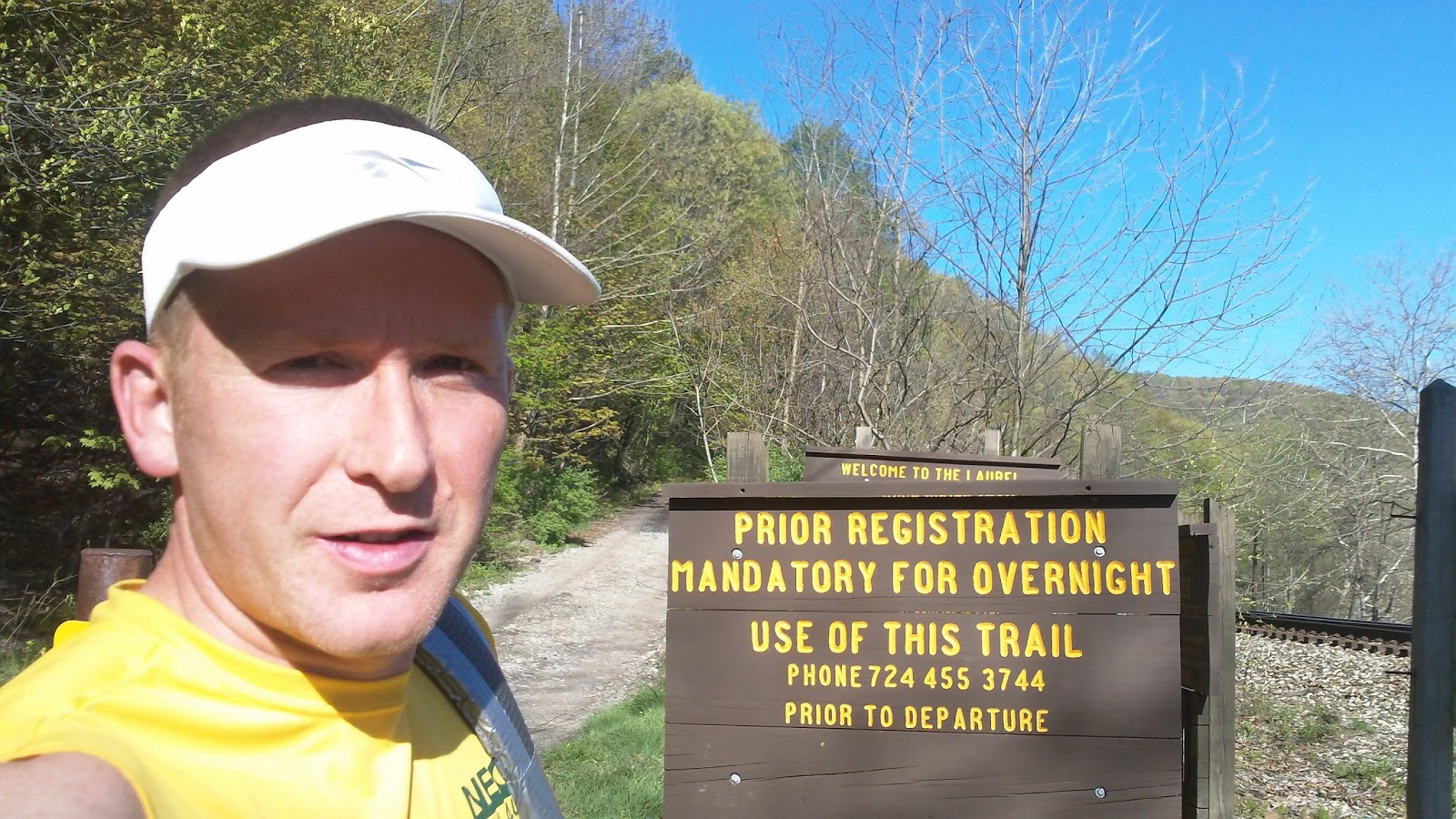
terminus. It is a 100% single-track trail except for a short section of less
than a mile that follows a gravel gas line access road.
The trail is a local backpacking favorite with three-sided
shelters sites spread out at day-hike distances along the trail and reliable
water sources along at known locations. The trail is also the backdrop to the
Laurel Highlands Ultra, an annual point-to-point foot-race held each June.
The Challenge
Lacking a race or event on my calendar, I started looking
for something to train for this past winter. I’ve found myself gravitating away
from “races” recently and toward less formal fun-runs and challenges. After
lots of brain storming, I finally settled on an unsupported long-distance foot-travel
journey. Several venues were considered, but the eventual best contestant
became the LHHT. Several different formats and dates were also tossed around in
my mind and for various reasons dismissed until only one option was left
standing: a self-sufficient double traverse of the LHHT.
History
I wasn’t the first person to take on this challenge. The
original double direction LHHT traverse was completed by Art Moore on Memorial
Day weekend in 1986. Art started and finished in Ohiopyle and his family
provided aid at the road crossings and paced him through the night sections to
a smoking fast 35:58:30 finish. Art’s monumental accomplishment was chronicled
in an article in the September edition of Ultrarunning Magazine that year. I
surmise that a thru-hiker or two have done a double traverse in a traditional
backpacking format, but I have not found any documented accounts other than Art’s.
(If anyone is aware of other successful attempts, please contact me or add a
comment to this blog so I can get in touch. I’d like to include other pertinent
historic information on this page.)
Philosophy
My approach to the challenge would be quite a bit different
than that of Art’s in 1986. My attempt would be an unsupported effort whereas Arts’ was fully-supported effort. These terms have specific meaning in the long-distance
foot travel community. (source: http://fastestknowntime.proboards.com/index.cgi?board=readfirst&action=display&thread=19)
Gear
An unsupported effort (sometimes called “alpine style”)
calls for carrying all supplies on your person from the start of the event, except
for water which may be obtained from native sources along the route.
Self-sufficiency requires that the selected gear be adequate for the expected
conditions (plus a safety factor). Here’s what I took:
Always Worn
|
Carried
|
Consumables
| ||
Sleeveless tech shirt
|
Home
|
4 Packs of Ramen noodles
| ||
Running shorts
|
MYOG 2.5Apex quilt
|
6 Packs of Oatmeal
| ||
Windshirt
|
Sleeping pad
|
4 cups of instant potatoes
| ||
Socks
|
Space blanket drop cloth
|
12 Cliff/Mojo bars
| ||
Shoes w/ gaiters
|
Wool socks (sleeping)
|
0.5lb Polish beef sticks
| ||
Visor
|
Flash 20 Basic Rucksack
|
2 Large Bagels
| ||
Rx glasses
|
Waterproof Pack Liner
|
20 Oreos/Sugar Wafers
| ||
Bandana
|
15 Reece cups/York PPs
| |||
Camera
|
Kitchen and Bath
|
2 Sleeves of Poptarts
| ||
Small Bubble Compass
|
3 Waterbottles: 2L Capacity
|
2x 1oz Jiff "Nutella" clone
| ||
Cooking kit (including stove)
|
12oz Crushed Frittos
| |||
Sometimes Worn
|
Hygeine kit
|
4 Coffee "tea-bags"
| ||
Water Treatment Tablets
| ||||
Clothing
|
Furnishings
|
Stove fuel for hot meals
| ||
Rain Jacket
|
Flashlight w/ spare battery
| |||
Med Weight LS Tech Shirt
|
Backup flashlight
|
Weight Totals
| ||
Balaclava and Watch Cap
|
Maps w/ notes
|
Worn: 4 lbs
| ||
1 pair Spare Socks
|
Vitriox knife
|
Carried: 5 lbs ("Base weight")
| ||
Light tech pants
|
First aid kit/Repair kit
|
Consumables: 5.5 lbs
| ||
Cell phone
|
Water (full capacity): 4.5 lbs
| |||


My gear kit was much more substantial for this effort than I
would carry for a traditional ultra-event. The philosophy in an ultra-event is
to carry just what is required to cover the distance between the aid stations
and nothing more. I often describe the feeling of getting to aid at an ultra as
“coasting in on fumes.” But this effort would be different. Instead of just
getting by I wanted to take on this challenge with a self-sufficient style. In
short, I wanted to thrive not just survive. Hence my gear looks like a
“10-Essentials” type list and the items were specifically and deliberately
selected to meet all the requirements of a long distance hike.
While this kit would adequate for an overnight trip or hike
of up to a week long (with proper adjustments in the consumable category) in
the warmer months and milder portions of the shoulder seasons, I wouldn’t
consider this a true 3-season list. Notably missing from the list is a true
shelter. For my double, I would use shelters located along the trail in the
event of severe inclement weather. Otherwise, my sleeping system is designed
for dry-weather, rough-camping on the forest duff under the stars.
The Effort
My hike started in Ohiopyle. After a hamburger at the Falls
City Pub, I shoved off at 5:40p.m. hoping to get to mile 8 by sun down. On the
climb out of OP I noted the flowering trees were in full bloom, but the leaves
on the hardwood trees had not yet opened and the looked like little green tubes
just poking out of their buds. The first evening’s effort went by very
uneventfully. Water is easily located in the southern half of the trail. I
carried 2L of water capacity, but due to the relative abundance in the southern
section I was able to match the amount I had to carry in my pack to the
distance to the next known source. In my research for this trip I located this
list from a fall 2012 thru hike on Dane’s place (http://www.shol.com/featheredprop/)
At the "Brown Gate" the first time
After the sun when down a crystal clear and cloudless sky coupled
with the still leafless trees made for a great star show as I hiked through the
night. At about 4:30 a.m. I passed the 35 mile, mid-point and found a good place to bed down for the night just north of the trail mid-point. I found a nice rock to lay beside
and spread out my bed roll and put on some warm clothes and sacked out. I woke
at 6:00 a.m. as the sun poked up from the horizon still warm in my quilt, but knowing
I needed to get moving. A breakfast of hot coffee and cold instant mashed
potatoes jump started my engine. I also had a serving of Jiff Silk peanut
butter and chocolate spread, which is my new favorite trail food, to eat with a
bagel.

Stealth Campsite on the First Night
I made good time through the morning and focused on keeping
my head up to see as much as I could. The LHHT has enough rocks and roots that at
a jogging pace you have to keep your eyes on the trail, but moving at a steady
hiking pace is much easier to keep your eyes on the scenery and the lack of
leaves meant that the trail was less of a “green tunnel” than usual. As the day
wore on the temps went up and I entered the driest part of the trail. North of
route 30 there are no streams that cross the trail and the only water is from
hand pumps located at the route 30 shelter area and route 211 parking area.
Here I filled up on as much water as I could carry.
I made it to the northern terminus just before 6 p.m. A
husband and wife were just packing up to hike out to the Decker Road shelter to
spend the night. We chatted for a few minutes and I gave them info on the water
situation on the trail. Their packs looked much heavier than mine and I was
very happy that I did not have to climb to the ridge with that much gear. Just before
sunset I stopped and topped off on calories for the night. Hot ramen noodles, instant
spuds and Fritos made up my smorgasbord.
The second night was much harder than the first as I had a
major fight with the sleep monster. It started with a groggy head started at
about 10:30 p.m. and got progressively worse as the night rolled on. My pace
slowed to a glacial trudge by 2 a.m., but I was determined not to stop till 4 a.m.
I’d much rather hike in the cool of the night than the heat of the next day. Time
seemed to slow down I as walked on through the dark and I deeply wished I had
packed a 5-Hour Energy in my food bag. I did get to see two porcupines overnight
which cool. I had heard that they are not frightful animals and this turns out
to be true. The first one was ambling through some fern shoots. I shined my
light on him he looked at me with a “I’m not afraid of you” over his shoulder
and then turned and slowly walked off into the night. At 4 a.m. I found a nice place to nap near the Route 30 crossing and woke at 7 a.m feeling much
better.
The hike from Route 30 south the next morning went well.
With the cobwebs of sleep lifted, I resumed my power hiking pace making it to
the well in Seven Springs by about 12:30 p.m. Just a marathon separated me from
Ohiopyle and this section is the one I’ve spent the most time on over the
years. I know this section of the trail well and it’s one of my favorites with
lots of picturesque stream crossings and interesting rock formations that the
trail snakes through.
By late afternoon I had only the 8-mile stretch just north
of Ohiopyle (I call them the “Gate 2-8”) to go but they are the toughest 8
miles of trail in Western PA. The section features three really tough climbs
the toughest of which is about 1,200 ft. My ears usually will pop when I go up
or down it. As I was making the first decent I noticed something. The trees
looked different than they had two days ago. The leaves that were tightly curled
green nubs two days ago had partially unfurled and a tiny leaf was taking shape.
The same overlook view that had looked barren two nights ago looked green and
lush. It was a drastic change I had not expected. I watched my third sunset
from the rock outcropping between mile marker 3 and 2. I checked my watch and
noted that with a little hustle I’d make it in under 51 hours.
I strolled past the brown gate at the end of Garrett Street
in the waning dusk and down to the Falls City Pub where I stopped. A guy sitting
at a table with a beverage told me I looked lost. I told him I was looking for
someone to take my picture and he offered to help. It was the perfect end to a
great hike. It was not an epic an adventure. It was not dramatic but it was
full of drama; a subtle drama that you can only perceive while moving down a
trail in the spring at a walking pace.

I’ve posted all the pictures I took from the hike here and with some narrative and captions as appropriate. Enjoy:
I tried to keep this report short and sweet. If I missed a aspect of the trip you're interested in post a comment below or shoot me a message.
EDIT May 7, 2013: I'm adding the table with the numbers from the outing:

EDIT May 7, 2013: I'm adding the table with the numbers from the outing:

Congrats on your double Laurel, Cam!! I can't think of any better trail, anywhere. Glad you got some real quality time out there.
ReplyDeleteKirstin
Congrats on completing this amazing feat. I was actually at the 11 mile aid station the day of the Laurel Ultra waiting for my teammate to pass in first place and heard you talking about this. At that time I thought I had heard you mention that you did the whole trail up and back! I told my cousin about you and he was like… there is no way! (My cousin wanting to do the whole trail on his own this summer) Low and behold I'm reading the March issue of Running times on my kindle fire right now and I come across an article about FKTs. I go to the website and your blog is one of the first things I noticed under the mid-atlantic section
ReplyDeleteWhat a small world it is…
Take care
Josh Hooke
Thanks for the note. Working aid at LHU was really fun and I get a kick out of watching people actualize their dreams and goals.
DeleteTell your cousin to get prepared and go for it! Better yet, go out and crew him or do it together. No time like the present.
Congrats! Love this!
ReplyDelete